NASA’s Quiet War: When Scientific Satellites Unmask Geopolitical Jamming
- Tech
Arjun Vedanta
- 0
- 5 minutes read
The Blurring Lines of Satellite Utility
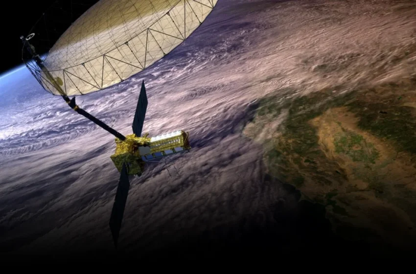
A recent, almost incidental discovery reveals that NASA satellites, ostensibly designed to observe cyclone wind speeds and collapsing ice sheets, possess an unexpected capability: pinpointing the approximate locations of GPS jammers. This isn’t just a technical footnote; it’s a stark illustration of how our civilian infrastructure is becoming an unwitting frontline in a silent, escalating electronic war, forcing us to re-evaluate the true purpose and vulnerability of assets in orbit. The original article, in its focus on the ‘how,’ missed the ‘what now?’ of this profound shift.
The underlying reality is that global navigation systems are under sustained assault. Reports of GPS interference and spoofing are no longer isolated incidents but a systemic problem affecting everything from commercial aviation routes over the Baltic Sea to maritime shipping lanes in the Black Sea and the Persian Gulf. In this context, the discovery that two different NASA satellite systems could identify a known, mysterious GPS jammer within several kilometers of its position in Iran—an experiment detailed by Sean Gorman, CEO of Zephr.xyz, in GPS World—serves less as a scientific curiosity and more as a tacit admission – or perhaps a subtle warning – regarding the increasing weaponization of what were once considered neutral global commons.
This revelation isn’t about mere technical prowess; it’s about the systemic erosion of foundational global services. Civilian aircraft and vessels rely heavily on accurate GNSS data for safe navigation. When that data is compromised, the ripple effect extends far beyond military operations, touching cargo logistics, emergency services, and even everyday consumer technology. The casual nature of the discovery underscores a dangerous trend: capabilities developed for peaceful scientific inquiry are being quietly repurposed or unintentionally revealing the contours of a new, terrestrial battlefield.
Scientific Payloads, Strategic Implications
NASA’s scientific missions have always been about understanding our planet, from Earth’s climate systems to its geological processes. The idea that these same instruments, never intended for signal intelligence, are now capable of mapping points of electronic warfare raises crucial questions about the expanding definition of national security assets. Clara Chew, a principal scientist at Muon Space, noted to Ars that while these satellites can’t offer ‘near-real time monitoring’ or ‘pinpoint the exact location,’ their ability to identify ‘high-risk areas for maritime shipping’ or assist in ‘flight planning’ is undeniably valuable.
Yet, the very framing of this capability as ‘accidental’ or ‘unexpected’ invites scrutiny. Is this truly an unforeseen byproduct of advanced sensor technology, or a conveniently revealed capability designed to signal a nascent counter-jamming posture without explicit declaration? The incentive here is multifaceted: demonstrating such a capability publicly could serve as a deterrent, subtly informing adversarial actors that their electronic warfare activities are not as opaque as they might assume. It also primes the public and policymakers for future investments in resilient navigation infrastructure, highlighting the acute vulnerability of current systems.
The data collected by these systems—even if not real-time—provides invaluable geospatial intelligence. Knowing *where* jamming occurs, even broadly, allows for patterns to be discerned, actors identified, and countermeasures developed. This silent monitoring represents a significant leap from reactive responses to proactive intelligence gathering. It speaks to a shift where every new orbital platform, regardless of its stated scientific objective, inherently carries a dual-use potential, subtly altering the strategic balance in an increasingly contested domain.
The Ascent of Unseen Electronic Warfare
The incident in Iran is not isolated. From the persistent GPS spoofing near Moscow’s Vnukovo Airport that makes planes appear to be hundreds of kilometers away, to the deliberate jamming affecting maritime traffic in the eastern Mediterranean, a shadow war for control of the electromagnetic spectrum is unfolding globally. This dynamic, often overlooked by Silicon Valley’s consumer tech obsessions, represents a fundamental challenge to global connectivity and security. The deployment of sophisticated electronic warfare capabilities by state actors is turning vast swaths of airspace and sea into zones of potential navigation chaos.
What this NASA discovery ultimately reveals is the profound inadequacy of our current frameworks for governing space and its uses. When scientific probes become de facto reconnaissance tools, the line between peaceful exploration and strategic advantage becomes irrevocably blurred. The future of global navigation, therefore, hinges not just on more robust satellite systems like Galileo or advanced LEO constellations like Starlink and OneWeb offering resilient alternatives, but on a clear-eyed acknowledgment that the integrity of our orbital infrastructure is now a key vector in international power projection. This isn’t merely about tech; it’s about sovereignty, commerce, and the precarious balance of a world increasingly reliant on signals from above.